


Haviland Voting District, Kiowa County, Kansas
About
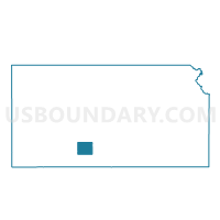
Outline

Summary
| Unique Area Identifier | 585564 |
| Name | Haviland Voting District |
| County | Kiowa County |
| State | Kansas |
| Area (square miles) | 160.23 |
| Land Area (square miles) | 160.21 |
| Water Area (square miles) | 0.02 |
| % of Land Area | 99.99 |
| % of Water Area | 0.01 |
| Latitude of the Internal Point | 37.63726630 |
| Longtitude of the Internal Point | -99.11511300 |
Maps


Graphs
Select a template below for downloading or customizing gragh for Haviland Voting District, Kiowa County, Kansas


Neighbors
Neighoring Voting District (by Name) Neighboring Voting District on the Map
- Belvidere Voting District, Kiowa County, KS
- Center I Voting District, Kiowa County, KS
- Franklin Township Voting District, Edwards County, KS
- Lincoln Township Voting District, Edwards County, KS
- Township 10 Voting District, Pratt County, KS
- Township 8 Voting District, Pratt County, KS
- Township 9 Voting District, Pratt County, KS
Top 10 Neighboring County Subdivision (by Population) Neighboring County Subdivision on the Map
- Kiowa Rural township, Kiowa County, KS (2,553)
- Township 9, Pratt County, KS (314)
- Township 10, Pratt County, KS (153)
- Township 8, Pratt County, KS (133)
- Lincoln township, Edwards County, KS (119)
- Franklin township, Edwards County, KS (80)
Top 10 Neighboring Place (by Population) Neighboring Place on the Map
Top 10 Neighboring Unified School District (by Population) Neighboring Unified School District on the Map
- Macksville Unified School District 351, KS (1,353)
- Greensburg Unified School District 422, KS (1,221)
- Skyline Schools Unified School District 438, KS (1,160)
- Haviland Unified School District 474, KS (898)
- Lewis Unified School District 502, KS (761)
Top 10 Neighboring State Legislative District Lower Chamber (by Population) Neighboring State Legislative District Lower Chamber on the Map
Top 10 Neighboring State Legislative District Upper Chamber (by Population) Neighboring State Legislative District Upper Chamber on the Map
Top 10 Neighboring 111th Congressional District (by Population) Neighboring 111th Congressional District on the Map
Top 10 Neighboring Census Tract (by Population) Neighboring Census Tract on the Map
- Census Tract 9691, Kiowa County, KS (2,553)
- Census Tract 9686, Pratt County, KS (2,163)
- Census Tract 9696, Edwards County, KS (1,512)